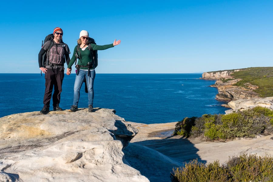
Ready for some of the best hiking in Sydney? In this post, we cover everything you need to know to plan and enjoy an incredible hike along the Royal National Park Coast Track from Bundeena to Otford.
Sydney, with its majestic harbour, iconic sites and stunning beaches, is irrefutably among the world’s most beautiful cities. It’s also a city fringed by nature, with vast swathes of bushland fanning away from the city on three sides, and the wide, blue Pacific Ocean to the east.
Among that bushland is Australia’s first national park – the world’s second oldest, just south of Sydney. It’s here that you’ll find one of our favourite coastal hikes: the Royal National Park Coast Track.
The Royal National Park was established all the way back in 1879, a pioneering environmental achievement in an era of industrialisation and rail expansion.
Today, the park spans more than 150 square kilometres; a hiker’s playground offering over 100-kilometres of walking trails. The various Royal National Park walks weave through eucalypt trees and rainforest, along rugged cliffs and coastal heathland, and past waterfalls, trickling creeks and white, sandy beaches.
The showcase jewel in this Royal crown is the coastal walk, officially known as the Coast Track. It’s a sometimes-challenging, ever-changing 26-kilometre trail along the park’s dramatic coastal edge, between the village of Bundeena and Otford Lookout to the south.
It’s a hike that can be done in a day if you’re fit, but can also be tackled in shorter segments, and in the future, when campsites are developed as part of the Great Southern Walk, hiked over multiple days with camping stops.
Hiking the Royal Coast Track – Snapshot
Location: The Royal Coast Track is in Royal National Park on the New South Wales south coast, around an hour south of Sydney, between the seaside villages of Bundeena and Otford.
Start & Finish: Bundeena to Otford Lookout.
Distance: 26-kilometres one-way (add around 3km more if you’re coming and going by public transport).
Time: The hike can be completed in a single day with an early start, or you can break it up and hike the south and north sections separately over a couple of days.
Difficulty: Medium to Hard (as occasional hikers, we can tell you it’s tough in places but very do-able. A reasonable level of fitness is required though, as there are plenty of steps and steep sections).
What’s in this post?
Planning for the Royal National Park Coastal Walk
– How to get to the Royal National Park in Sydney
– Best time of year to hike the Coast Track
– Where to stay
– What to pack
What to Expect Hiking the Royal National Park Coast Track
– The Royal Coast Track
– Trail conditions
– Facilities on the Coast Track
– Safety tips for Royal National Park hikes
Our Experience Hiking the Royal National Park Coast Track
– Leg 1: Bundeena to Wattamolla
– Leg 2: Wattamolla to Burning Palms
– Leg 3: Burning Palms to Otford Lookout
Useful Travel Resources
This post contains affiliate links. If you choose to buy through these links we may earn a small commission at no extra cost to you, which helps us to keep Two For The World running. Many thanks for your support!
Planning for the Royal National Park Coastal Walk
How to get to the Royal National Park in Sydney
By public transport
Getting to and from the Royal Coast Track by public transport is a cheap and relatively straightforward option no matter which direction you’re trekking; it just requires some bus and ferry timetable planning.
To get to Bundeena, take a train to Cronulla, walk a couple of minutes to the pier and take the hourly ferry across Port Hacking to Bundeena. The whole journey should take around 90 minutes.
At the Otford end, continue walking for another 2 kilometres beyond Otford Lookout to the Otford train station. From there, you can train it back to Sydney.
Or vice versa.
By car
Bundeena is located around 55km south of central Sydney – you’ll need to follow the A1 Princes Highway south until you get to Loftus, where you’ll see signs pointing you left towards the Royal National Park and Bundeena.
Getting an early start should allow you to avoid the worst of Sydney’s traffic and make the journey in around an hour, maybe a tad more.
If you’re travelling with friends and have access to two cars, you can park one at each end of the hike – this is what we did. You’ll park one car at the track head on Beachcomber Avenue in Bundeena, and the other at Otford Lookout.
If you only have one car, you’ll need to find a way back to your starting point, which will involve a version of the train-and-ferry combo outlined above, regardless of which end you park at. Probably more hassle than taking public transport both ways.
If you want to hire a car to get to and from the Royal National Park Coast Track, we’d suggest checking out DiscoverCars. They’re our booking engine of choice for car rentals, and allow you to easily compare vehicles, prices and rental conditions across a wide range of hire car providers, including major outlets and smaller local providers in the places you plan to visit.
Booking your Sydney car hire in advance will get you the best rates and widest choice of vehicle, particularly if you’re travelling in the busier months. You can find and book your Sydney car hire with DiscoverCars here.
Best time of year to hike the Coast Track
The Coast Track can be hiked year-round, but there are some seasonal drawcards worth planning for.
Wildflowers colour the trail in Spring, while longer days in summer mean you have more time to walk and enjoy the spectacular beaches en route.
We deliberately chose winter for our trek so we could spot migrating whales off the coast as we hiked. It did mean less hours of daylight and cooler weather; we just made sure to carry extra layers and get on the track as early as we could.
Weather can, of course, undermine the best laid plans at any time of year, so keep tabs on the forecast before you set out. It’s also important to check the NSW National Parks website in the lead up, to make sure there are no alerts or closures in the park that might affect your hike.
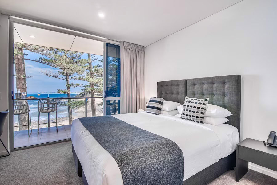
Where to stay
There are a number of options if you want to stay near the start or finish of the Royal Coastal Track. Accommodations range from cosy guesthouses to apartments, coastal rentals, and high-end holiday homes perched above the cliffs.
Bundeena and Cronulla are your best options for a stay at the north end of the trail.
Bundeena offers a laid-back, coastal village feel with beach access, and decent ferry and road links – although options are more limited here and tend to be geared towards the holiday letting market and longer stays.
Cronulla is a much busier coastal suburb that’s also on the train line. It has a very popular beach and better tourist infrastructure, like shopping, cafés and bars, along with a wider choice of hotels and apartment stays.
South of the trail, you’ll find pretty beach suburbs like Stanwell Park, Coledale, Austinmer and Thirroul spread out along the coast. All of these suburbs are connected by the rail line and have a typically laid-back Aussie beach town vibe, with Austinmer and Thirroul tending towards slightly more up-market stays.
If you’re looking for somewhere comfortable to stay before or after your hike, or if you’re thinking of having an extended beach stay in the area, the options below get consistently good reviews.
Stays north of the Royal Coastal Track
- Fogo @ Ethel & Ode’s: An adults-only studio right above the rocks in Bundeena, Fogo offers ocean views with peace and privacy. With a full kitchen, breezy deck and uninterrupted ocean outlook, it’s a fab spot to unwind before or after you hit the trail.
- Rydges Cronulla Beachside: Sitting right on Cronulla’s main beach, Rydges is just steps from cafés and the surf, offering spacious rooms with balconies, a pool and a resort vibe, making it the perfect base to settle in before or after your walk.
- Seabreeze Cottage Bundeena: Tucked in a quiet garden just minutes from Horderns and Gunyah beaches, this one-bedroom cottage has a local homestay vibe with hotel-level comfort. It’s ideal if you want an easy, self-contained base at the northern trailhead.
- Cronulla Beach House B&B: This boutique guesthouse blends seaside charm with warm hospitality just a short stroll from Cronulla Beach. Beautifully kept rooms, thoughtful touches and a relaxed setting make it a favourite for easing into (or out of) trail mode.
Stays south of the Royal Coastal Track
- Thirroul Beach Motel: This clean and comfortable motel is perfect if you want to roll straight from the trail to the beach. With simple rooms, free parking and an easy walk to cafés, it’s a decent, hassle-free option for tired legs.
- Townhouses by the Beach: Particularly good for a group stay, these spacious townhouses offer full kitchens, balconies and room to spread out. It’s a homely, comfortable base just a short stroll from the water and local amenities.
- Romantic Ocean View Studio at Stanwell Tops: Perched high on the escarpment, this luxurious studio delivers sweeping ocean and rainforest views with complete seclusion. It’s the perfect reward for completing the trail – peaceful, elegant and utterly relaxing.
- Headlands Austinmer Beach: Overlooking one of the Illawarra’s prettiest beaches, Headlands pairs sleek, modern apartments with resort-style perks like a pool, bar and restaurant. It’s a stylish way to round off your hike with ocean views and a perhaps, a cheeky cocktail.
Staying in the Royal National Park
There are three lovely refurbed cottages that you can stay at within Royal National Park. These can be booked via the NSW National Parks website (aim to book well ahead if want to nab one of these).
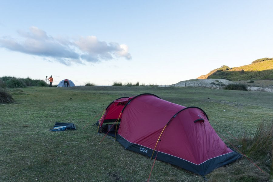
You can also camp near Bundeena at Bonnie Vale Campground in the park, not far from the north end of the trailhead. Camping sites can also be booked online.
Camping was previously possible at North Era Campground, around 18km along the trail from Bundeena. Unfortunately the site is closed until further notice, so there isn’t currently anywhere to camp along the hiking trail itself (it’s not permitted to wild camp in the park, you can be fined if you do so).
We’ve learned that new campgrounds along the trail are proposed for Wattamolla and Garie as part of the Great Southern Walk, but at this stage there’s no firm timeframe on when these might happen.
What to pack
The Royal National Park Coast Track may be close to Sydney, but it still demands proper preparation. The route covers exposed headlands, beaches and bushland, and weather can shift quickly along the coast – so it pays to be ready for heat, wind, sun and showers.
Footwear: Much of the track is uneven or sandy, with rocky sections, boardwalks and creek crossings. A sturdy pair of hiking shoes or trail runners with good grip will make a big difference over the 26km.
Clothing: Hiking in Sydney, or anywhere in Australia for that matter, will expose you to the harsh southern hemisphere sun, regardless of the time of year you hike. So it’s essential to always pack a hat, sunglasses and sunscreen. Of course, the best way to cool off is to take a dip in the ocean; bring a towel if you plan to make the best of the many beaches along the trail.
The weather can change rapidly by the coast; pack lightweight, breathable layers and a light rain jacket or windbreaker in case the weather turns. Even on fine days, the coastal breeze can be surprisingly cool once you stop moving.
Food and Drink: As the Royal Coastal Track is quite exposed for long stretches, it’s advisable to take as much water as you can. We took a couple of litres each, along with snacks to keep our energy up, including trail mix, jerky and energy bars. We also pre-made a packed lunch that we kept cool in our backpacks. There are plenty of clifftop lookouts and beaches that make perfect picnic spots for a mid-hike break.
Camera: Between the dramatic sea cliffs, waterfalls and wild coastal views, this is a hike you’ll want to photograph. A decent camera or even a smartphone with a wide-angle lens will help you capture those sweeping ocean vistas and secluded beaches that make the Royal Coast Track so special.
Other Essentials: On longer hikes like this one, we always take a basic first aid kit and blister patches, a pack cover for our bags, and portable power banks to charge phones and cameras. We also take binoculars for birding on any trails we hike (if you decide to tackle the Royal National Park coastal walk between May and November, they’ll come in extra handy for spotting whales migrating along the coast at this time of year).
What to Expect Hiking the Royal National Park Coast Track
The Royal National Park coastal track is a full-day hike through a spectacular coastal landscape that’s among the best hiking in Sydney.
While it’s close to the city, this feels like a proper wilderness experience. The trail is long, exposed, and can be physically demanding, especially under the summer sun, so a good level of fitness and preparation is essential.
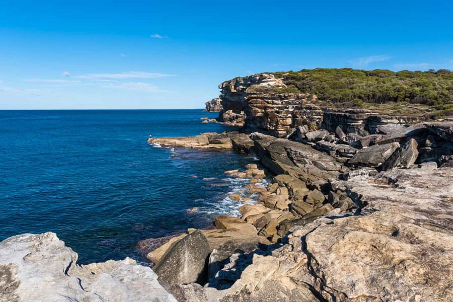
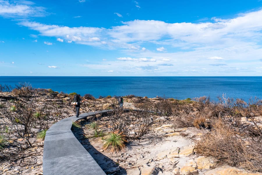
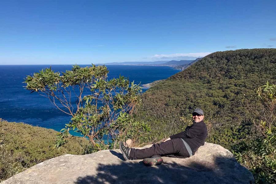
The Royal Coast Track
The trail winds through the heart of the Royal National Park in Sydney, linking secluded beaches, towering sea cliffs, and coastal heathlands rich in birdlife and wildflowers.
Starting from Bundeena, the path skirts sandstone headlands before dropping to Garie Beach, then climbs again to open clifftops with sweeping Pacific views.
You’ll pass highlights like Eagle Rock, Curracurrong Falls, and the Figure Eight Pools (check tides before detouring), before climbing through lush forest to Werrong Point and on to Otford.
Trail conditions
The Royal National Park coastal track is clearly marked and well maintained, but it’s still a serious coastal trek that demands fitness, planning, and good footwear.
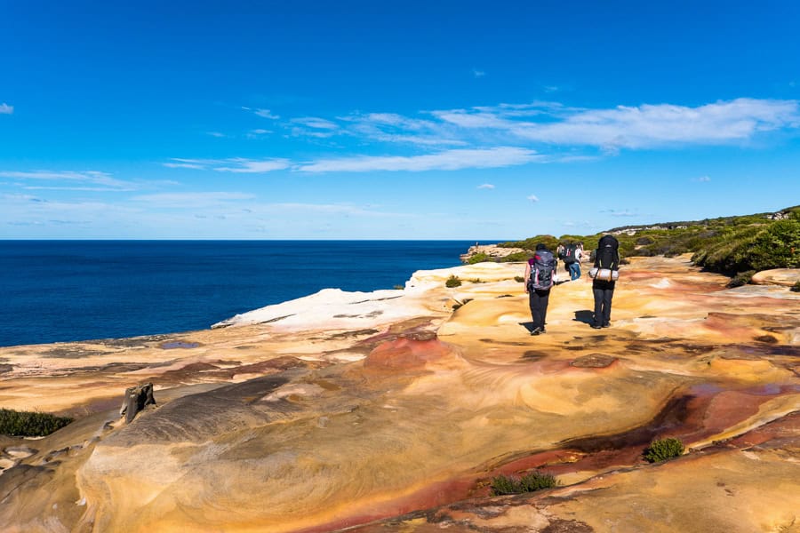
Expect a mix of trail surfaces – from compacted dirt and sandy paths to raised boardwalks, rock slabs, and uneven stone steps carved into the cliffs. Some stretches, especially around Garie, Wattamolla and Otford, involve long climbs and descents that can feel a bit relentless in the heat.
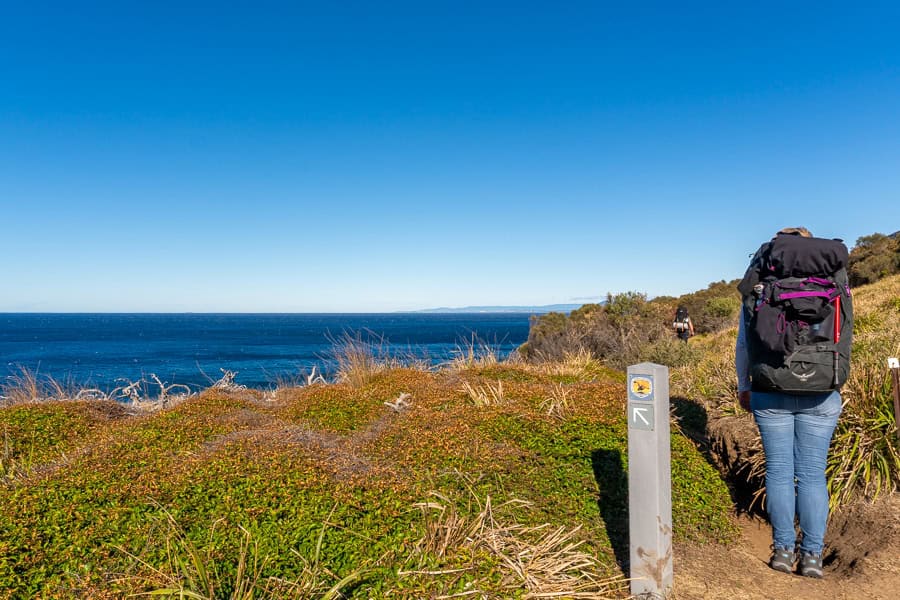
Trail markers are frequent and easy to follow, with signage at major junctions and small Coast Track posts along the route.
In warmer months, the combination of heat, distance, and exposure can make this hike a much tougher challenge than its proximity to Sydney might suggest.
Still, for us, this trail captures some of the best hiking in Sydney – combining rugged cliffs, hidden coves, and ocean panoramas that seem to stretch forever.
How long do I need?
Twenty-six kilometres is no small walk in the park but it’s well worth the effort. And you certainly don’t have to do the whole trail in one go – you can do out-and-back legs from either end, or arrange transport so you can leave the trail at Wattamolla or Garie Beach and tackle the route in different stages at different times.
We’ve hiked segments of the Royal National Park Coast Track over several hours and half-days, and we’ve also walked the full trail over two days, camping overnight along the way (sadly, this isn’t possible at the moment – see more below).
Hiking the full 26km route between Bundeena and Otford takes most hikers between 7 and 10 hours. We’ve also seen runners on the trail, but it’s safe to say we’re not quite that committed, and nowhere near fit enough!
At our leisurely pace, with plenty of breaks for resting, snacking, hydrating and soaking up the scenery, we fall squarely into the average hiking time bracket, although leaning more towards 10 hours.
If you just want to do a section, head to Our Experience of Hiking the Royal Coast Track to get a sense of roughly how long each leg will take and what to expect.
Plans for the Great Southern Walk
We personally feel that the best way to experience this iconic hike is to do it over two days and spend a night within the park under the stars.
We have happy memories of doing it this way and were planning to do it again. So we were disappointed to discover that it’s not currently possible as North Era Campground, the only place along the trail where camping was permitted (apart from Bonnie Vale Campground near the northern trailhead) has closed.
The upshot is that there are exciting plans afoot to create some new campgrounds along the trail as part of the Great Southern Walk, a 67km walk between Kurnell and Wollongong via the Royal Coastal Track and the Illawarra Escarpment.
New campgrounds are proposed for Wattamolla, Garie and Garawarra Farm, which will make a big difference to the segment splits of a two (or more) day hike along the coast.
There isn’t a timeframe for when these new campgrounds will open, but planning and design is underway. There are also trail works taking place as part of the project; another reason to keep tabs on Coast Track alerts before you set out.
Which direction should I hike?
You can hike the Royal National Park Coast Track in either direction – from Bundeena to Otford or the reverse. It used to be possible to tackle the hike over two days with a night at North Era Campground, but as the campground has closed, the walk is now best approached as a one-day challenge (for fit, experienced hikers) or in shorter sections from either end.
If you’re up for the full 26 kilometres, we’d suggest starting in Bundeena and walking south. It means the sun’s at your back for much of the day, although it does feel like there’s more climbing going in this direction.
Alternatively, you can break it up into manageable day walks, like Bundeena to Wattamolla or Garie Beach to Otford, both of which cover many of the trail’s highlights without committing to the full distance.
Either way, you’ll get a spectacular taste of Sydney’s wild coastline and some of the most striking ocean views in New South Wales.
Facilities on the Coast Track
Facilities along the Royal Coastal Track are limited, so it’s best to start the day fully prepared. Once you set out between Bundeena and Otford, there are no cafés, bins, shops, or reliable water refill points along the trail – just wild coastline and a few scattered picnic areas.
Where to park
The northern trailhead starts near the end of Beachcomber Avenue in Bundeena, where there’s a very small carpark (Google map) for maybe 6 or 7 cars. Spaces fill up quickly, especially on weekends and holidays, so aim for an early start if you want to get a space, or park on adjacent streets. On the southern side, there’s also a small parking area (Google map) near Otford Lookout.
Within the national park, there’s day parking at Wattamolla and Garie beaches. The cost of parking here is included in the the Royal National Park entry fee of $12 per vehicle (there’s also annual park membership if you’re a more frequent park visitor).
Payment can be made at staffed national park entry booths, or at ticket machines within the park. If you’re using any car park within the park, make sure you display your printed entry ticket on the dashboard of your car to avoid getting a parking fine.
Are there toilet facilities along the way?
If, like me, you prefer facilities to outdoor bio-breaks, you’ll be relieved (pun intended) to know that there are a couple of toilet stops along the Coast Track.
There’s a decent semi-permanent portaloo set-up at the track head in Bundeena, and flush loos at Wattamolla, around 4 hours into the trek. From Wattamolla, it’s a 2.5 hour hike to the next toilets at Garie Beach. Then there are drop toilets behind North Era Beach where the campground used to be, just 45 minutes further on (though we’re yet to confirm if these are still accessible now the campground is closed). There are no toilets between North Era and Otford Lookout.
Leave no trace: Be prepared to carry out everything you carry in for your Royal National Park bushwalk, including all your rubbish. That means toilet paper too. There’s nothing worse than stepping into a pile of used loo roll that someone has left behind in the bush.
When we hike, we pre-pack a ziploc bag with degradable doggy bags, toilet paper, hand sanitiser and some extra ziplocs so we can dispose of toilet paper discreetly and carry it out with us.
Hopefully, given the length of the coastal walk and the facilities en route, you won’t need to worry about digging any poop holes on this trek, but if you do, read this.
Is there drinking water along the Coast Track?
There are no official fresh water sources along the Coast Track, and it’s recommended that you do not drink from the creeks in the park. Carry in as much water as you think you’ll need for the hike, and then some more. Or bring some method of water purification with you.
We have previously passed a tap hooked up to a rainwater tank with a ‘drinking water’ sign outside the community hall on the trail through the Burning Palms community. This was on the stretch between North Era and Otford Lookout, and it was a very welcome top-up for us – thank you, Burning Palms people!
Garie Beach also has a kiosk that’s usually open on weekends and public holidays. You may be able to buy bottled water if you’re in need.
Don’t rely on either of these options though, it’s best to BYO.
Cafés and kiosks
There are no permanent cafés or kiosks along the trail itself. If you want a pre- or post-hike coffee or meal, head to Bundeena’s local cafés near the ferry, or one of Stanwell Park’s beachside eateries at the southern end.
During peak season and school holidays, you may find the small kiosk at Garie Beach open for basics like drinks, ice-creams and pies. Hours and days vary though, so don’t rely on it for a meal or as a reliable water refill point.
Visitor information
For the latest updates on track conditions, closures or other park alerts, check the NSW National Parks and Wildlife Service website or drop by the Royal National Park Visitor Centre at Audley, about a 20-minute drive from either trailhead.
Safety tips for Royal National Park hikes
Although the Royal Coast Track is just an hour from Sydney, it’s a serious full-day coastal hike where conditions can change quickly. Come prepared, wear sturdy shoes, and carry enough water and food for the day – there are no reliable water refill points or cafés once you’re on the trail.
Weather conditions: Check the forecast before setting out. The NSW coast can be hot, windy or suddenly stormy, and there’s little shelter along exposed sections. Avoid hiking during extreme heat or high wind, and note that parts of the trail can be slippery after rain. Always check for any Royal National Park alerts or track closures on the NSW National Parks website before you go.
Stay on the trail: The track is well marked and managed, with plenty of directional signs and coast track post markers. It’s important to stick to the designated path to protect fragile ecosystems and avoid cliff hazards. Keep clear of unfenced edges, especially near lookout points and sea cliffs where gusts can be strong.
Tides and surf: If you’re planning to visit the Figure Eight Pools or any rock platform areas, always check tide and swell conditions first. Access is only safe at low tide and during calm seas.
Water and supplies: Carry at least 2-3 litres of water per person, sunscreen, a hat, and plenty of snacks. The trail crosses beaches and open heath with very little shade, so dehydration and sun exposure are real risks, especially in summer.
Emergency contact: In case of an emergency, call 000 (or 112 from a mobile). Mobile coverage can drop out in sections, so let someone know your plan and expected finish time before you set off. While park rangers visit popular areas such as Wattamolla and Garie, and surf life savers patrol some beaches in season, there is no guarantee of patrols along the full trail.
Our Experience Hiking the Royal National Park Coast Track
Leg 1: Bundeena to Wattamolla
There are two options for starting the Coast Track at Bundeena: the trackhead at the end of Beachcomber Avenue, or via Jibbon Head, where you can visit some Aboriginal rock engravings en route.
If you’re planning to do the whole 26km trail in one go, it’s best to work out how much daylight you’ll have at the time of year you’re hiking, and base your start time around this.
At a leisurely pace, this first 9-kilometre stretch between Bundeena and Wattamolla should take around 4 hours or so.
Shortly after setting out, you’ll be fronting up to ocean views, followed by your first glimpses of the sweeping, rugged cliffs that make this hike a panoramic standout.
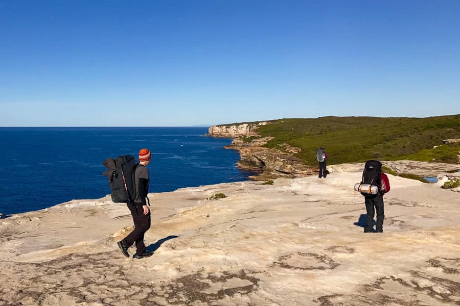
You’ll be tracing sandstone cliffs and headlands for the first half of the trail, where you’ll be fully exposed to the elements – sunscreen, sunnies and a hat are essential.
Prepare to be regaled by some seriously spectacular coastal views for the first leg of the hike. In addition to dramatic cliff scenes, you’ll pass highlights early on such as the Waterrun, a 16-metre high waterfall crashing into the sea, and Wedding Cake Rock, a slab of blinding white sandstone forming layered tiers on the cliff edge.
Overdoing it for the ‘Gram: Wedding Cake Rock used to be accessible, at one point becoming a hugely popular pilgrimage site for Instagrammers, despite the trek to reach it. Then a geological survey found the fragile rock to be unstable and therefore unsafe, and these days it’s completely fenced off.
Walk the perimeter to the far side though, and you’ll be able to see the rock in profile (along with the huge crack running through it).
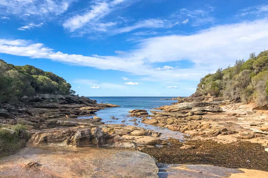
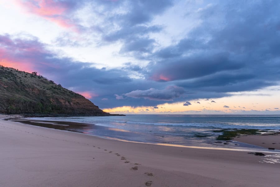
There are a handful of pristine beaches on this Royal National Park hike, some of which you’ll have almost entirely to yourself. The first stretch you’ll traverse on is Marley Beach – a welcoming curve of pale sand edging a turquoise bay.
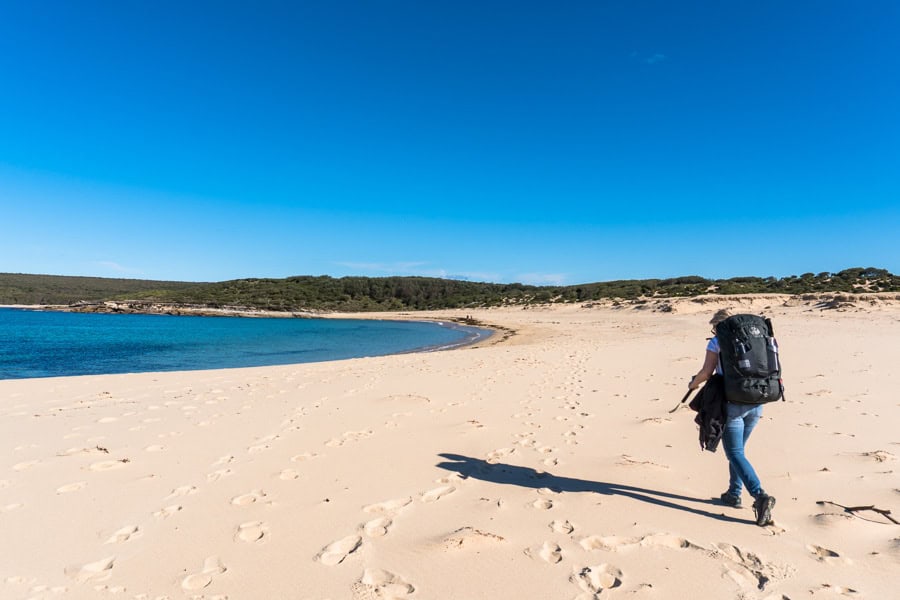
While we were content to skirt the shore on our winter hike, Marley must be a very tempting stop for a summer dip.
Just be wary, all of Royal’s beaches are pounded by the Pacific, and while some of them are top surfing spots, they can be hazardous for swimming. If you’re keen to get in the water en route, some of the beaches you’ll pass – like Garie, Wattamolla and Burning Palms – are patrolled by surf lifesavers during the warmer months.
More jaw-dropping ocean panoramas await as you continue on, perfect for spotting marine wildlife like seals, dolphins, and migrating whales in winter. We even spotted a couple of turtles surfacing. Some 300 species of bird have also been sighted in Royal, so keep your eyes peeled, and don’t forget to bring your binoculars!
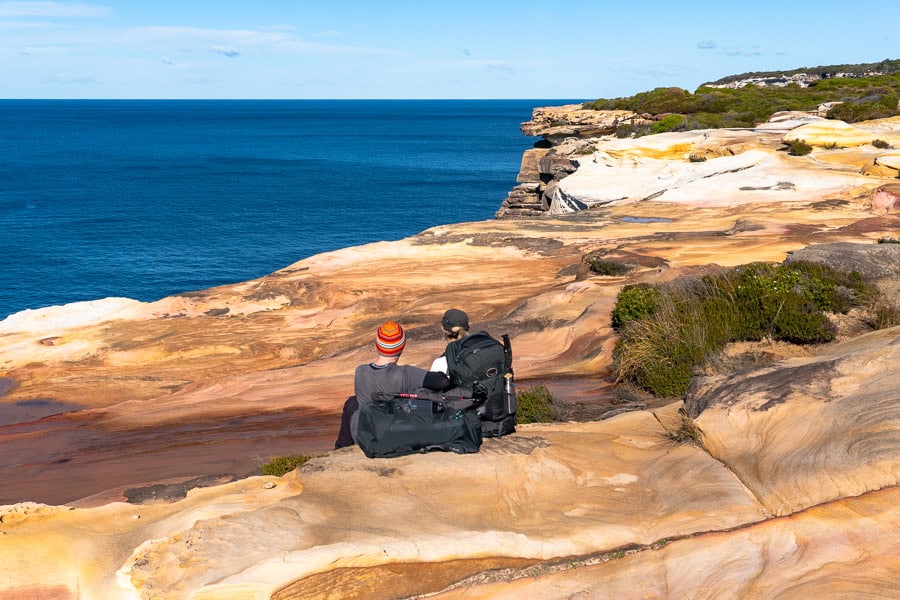
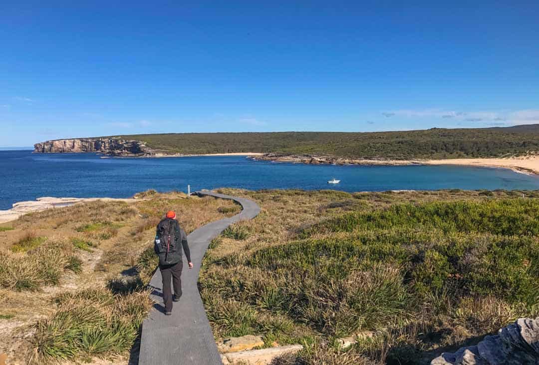
Around 4 hours after setting out, you’ll hike into Wattamolla. This corner of the park is accessible by car and, with its sheltered lagoon and beach, Wattamolla is a very popular spot for day visitors.
Leg 2: Wattamolla to Burning Palms
It’s around 11.5km from Wattamolla to Burning Palms, and you can expect this leg of the Royal Coastal Track to take around 3 to 4 hours, depending on how many breaks you take.
To be honest, despite its lovely setting, after our hours of relative solitude on the first leg of the trail, we were a bit overwhelmed by the crowds at Wattamolla.
If you haven’t been here before though it’s certainly worth a stop. There are toilets, barbecues, and a shaded picnic area – and the beach is an absolute stunner.
But as we wanted to avoid the crowds, we decided to continue on past the beach until we came to a quiet lookout to stop for lunch and a spot of whale watching.
Spotting whales from the Coast Track
Whale watching is a huge drawcard for walks in the Royal National Park during the cooler months of the year.
Between May and November, humpbacks and southern right whales make an epic annual migration between their cold water feeding grounds in Antarctica, and the warmer waters of the tropics, where they breed and calve.
If you’re on the Royal National Park coastal walk over this period, there’s a very good chance you’ll spot these gentle giants surfacing to breathe, frolick and – if you’re lucky – breach.
As you continue on, keep your eyes peeled for the beak-like Eagle Rock, and the waterfall at Curracurrong, before you eventually reach the high point of Garie North Head, overlooking beautiful Garie Beach.
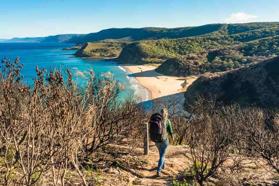
There are surf lifesavers at Garie during the summer months, so it’s a good option for a swim if you need to cool down and take a break.
After Garie there are just two more headlands before you reach North Era Beach.
We’ve camped at North Era in the past, and a night under the stars here was a big highlight of the Coast Track for us, as was watching the sky turn polychrome over the headland at dawn. Sadly though, for the time being the campground here is closed, so you’ll need to rustle up your last reserves of energy to get you to the end of the trail at Otford.
As you leave North Era, you’ll climb out of the valley and pass through the South Era beach shack community. From here you’ll make your way on to Burning Palms, another community with a popular surf beach.
The cabin communities of Royal National Park: As you hike the Coast Track, you’ll pass through three small beach shack villages. I know what you’re thinking: what’s their story? And more importantly, how can I get one?
Royal’s cabin communities were formed back in the 1920s and 30’s, when the Depression drove poor, out-of-work families on to the land around Royal to hunt and grow their own food. Those families went on to build cabins on what was then privately-owned land, which was later absorbed into the national park.
These days, the cabins are heritage-listed and held under lease by the descendants of their original owners. So unless you know someone who knows someone, the best you can do is daydream about having your own little beach shack weekender in the park.
Leg 3: Burning Palms to Otford Lookout
If you’re travelling north to south on the Coast Track, the final stretch between Burning Palms and Otford is a manageable 5.5km.
At Burning Palms, you’ll find a turn-off from the track to the beach and Royal’s famous Figure Eight Pools, which we personally have yet to visit as time and tides haven’t been on our side.
It’s a bit of an effort to reach these hourglass-shaped rock pools, and the conditions must be right. To reach the pools, you need to hike to the southern end of the beach and then along the headland rocks. Safety is imperative – they can only be accessed when the tide is low, and the weather and waves are calm, so it’s vital to check weather, tides, and the wave risk forecast on the NSW National Parks website before you head there.
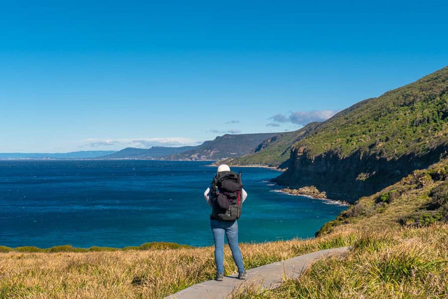
The final couple of hours of the Royal Coast Track offer a very different feel from the sandstone-and-heath landscape you traversed earlier.
After passing along a grassy coastal slope, you’ll come to the exotic-sounding Palm Jungle: a dense, tangled coastal rainforest of cabbage tree palms, swinging vines and tropical vegetation.
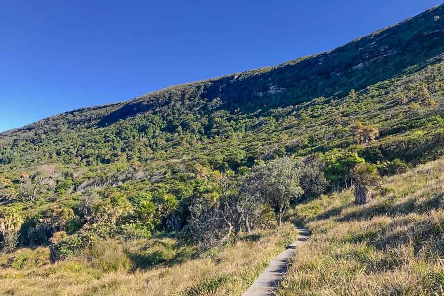
From there, you’ll leave the open sea views for a bit as the trail moves inland and climbs through a tall eucalypt forest.
You’ll eventually come to one of the last big views of the trail at Werrong Point. We made a pit stop here before our final charge to the end of the trail at Otford Lookout.
If you have a car parked at the lookout, then this is the end of the trek for you – well done! If you’re catching a train, it’s just a further 1km walk to Otford Station.
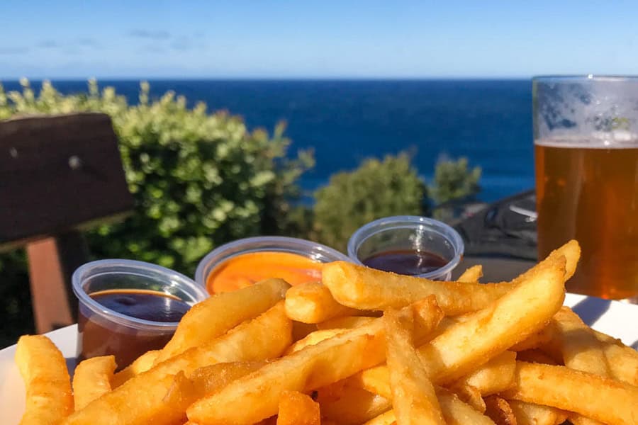
At this point (and depending on the time), you could hit up the Otford Pantry just down the road from the lookout and reward yourself with a well-earned pie and coffee. It’s open Saturdays, Sundays and Mondays till 4.30pm.
Or, if you have a car parked at Otford Lookout, just 15-minutes south you’ll find the Scarborough Hotel, a heritage pub with a sprawling beer garden on the cliff edge; it’s the perfect spot to wind up a Coast Track walk with a beer and one last view of the Pacific. The pub is open till 5pm daily. You can also take the train from Otford to Scarborough.
That’s a wrap on the Royal Coast Track! Whether you do it in stages over multiple visits, or in one epic full-day hike, this is one great Aussie coastal walk you won’t soon forget. We can’t wait to do it again!
Useful Travel Resources
Stays: We use Booking.com for its wide choice of stays and Genius perks.
Airport Transfer: Welcome Pickups make city arrival and departures a breeze.
Car Rentals: We use DiscoverCars for a wide choice of hire cars with great rates and free cancellation.
eSIMs: To stay connected when travelling, we use Airalo eSIMs
Tours: Check out GetYourGuide to find a great range of tours and local experiences.
We hope you enjoy your Royal Coastal Track hike as much as we loved ours. If you’ve got any questions or comments, drop us a message below.
If you’re planning to spend more time down under, check out our Australia page here, or check out our Adventure page for more inspiration for hiking and outdoor experiences around the world.
Hi there,
I know there isn’t explicitly a campsite, but would you recommend somewhere nice to camp to split the 18km section into 2? I’d love to do this over 3 days ideally… thanks!
Nadia
Hi Nadia, thanks for your message! Looking into this has actually brought to our attention that the Coast Track is currently closed between Garie and Little Garie Beach, so it’s not possible at present to walk the full length of the trail from either end. It would be great if there was another place to camp along the 18km stretch of the trail – it would be even better as a 3 day walk! Unfortunately North Era Campground is the only place along the trail where camping is allowed, and that too is currently closed until further notice. Wild camping in the park isn’t permitted and can attract fines. Hopefully the trail and the campground open again soon but we recommend keeping tabs on the NSW National Parks website for updates. Cheers!