Thinking about hiking the Routeburn Track? Here’s what to expect on this iconic New Zealand Great Walk, including how to plan and book, plus a day-by-day overview.
One thing we’ve discovered while travelling New Zealand is that adjectives very quickly fall short.
There are only so many words that can truly express the awe we feel around almost every bend in the road in this gorgeous island nation. After a while, we’re usually reduced to whispered wows and wide eyes to share our appreciation of the scenes unfolding around us.
That sense went into overdrive when we hiked the spectacular mountainous landscapes of Southland on New Zealand’s South Island, where snowy alpine ranges meet glacier-gouged valleys and fiords.
Trekking in New Zealand is off the charts amazing and it’s here, in this eye-popping corner of the country, that you’ll find some of the best of the New Zealand Great Walks series.
Including the renowned Routeburn Track, acclaimed by many as the country’s best multi-day hike, and a regular turn-up on lists of top hikes around the world.
As our first NZ Great Walk, we knew we were in for a treat. The Routeburn Track weaves a route through the mountain ranges and valleys of Te Wāhipounamu–South West New Zealand World Heritage Area: 33 kilometres of eye-wateringly beautiful landscapes.
In this post, we share our experience hiking the Routeburn Track over 3 days and 2 nights. We cover off what you need to know in advance, how to get there, where to stay before, during and after the trek, how to make your Routeburn track reservations, what to expect on the trail, and more.
The Routeburn Track is, in our opinion, one of the very best walks in New Zealand, if not the best. It literally took our breath away. A good thing too, because, well, words just aren’t enough.
Hiking the Routeburn Track – Snapshot
Location: Mount Aspiring National Park & Fiordland National Park – South Island, New Zealand
Start & Finish: You can hike the Routeburn Track in either direction between the Routeburn Shelter (70km north-west of Queenstown) and The Divide (85km north of Te Anau)
Distance: 33km (20.5 miles) one-way
Time: 2 to 4 days, though typically hiked over 3 days and 2 nights
Difficulty: Categorised by NZ’s Department of Conservation (DOC) as an Intermediate track during the Great Walks season (November to April). This means it’s suitable for trampers with some remote area hiking experience, and a moderate level of fitness.
In the off-season (May to October), the track is rated Advanced to Expert due to winter weather, challenging conditions, additional risks and hazards, and very limited facilities. Over this period, it should only be tackled by fit and experienced backcountry trekkers with appropriate equipment and skills.
Overnight stays: There are three huts with bunks and two campsites along the trail – they must be booked in advance during the Great Walks season. There’s no freedom camping on the Routeburn.
What’s in this post?
Preparing for a Hike on the Routeburn
– Best time to hike the Routeburn Track
– Routeburn Track reservations
– Huts and campsites on the trail
– Routeburn Track booking fees
– How to get to the Routeburn trailheads
– What to pack
– Where to stay before and after the trek
Hiking the Routeburn Track – What to Expect
– Trail conditions
– Visitor centres and facilities
– Phone reception, internet and power
– Water supply
– Safety tips
Our Experience on the Routeburn Hike
– Day 1: Routeburn Shelter to Routeburn Flats
– Day 2: Routeburn Flats to Lake Mackenzie
– Day 3: Lake Mackenzie to The Divide
Guided Routeburn Hikes
Useful Travel Resources
This post contains affiliate links. If you choose to buy through these links we may earn a small commission at no extra cost to you, which helps us to keep Two for the World running. Many thanks for your support!
Preparing for a Hike on the Routeburn
Best time to hike the Routeburn Track
While the Routeburn Track can be attempted year-round, the DOC recommends that people hike during the Great Walks season (November to April).
These are the warmer months in the southern hemisphere and the weather is milder, though conditions are still changeable and you can expect rain at any time.
Outside of the Great Walks season, you’re contending with colder, wetter conditions, shorter days, ice and snow, and a greater chance of avalanches and flooding.
Off-season, there are no rangers at the huts, and hut facilities are scaled right back (even the flush loos are taken out of service). Contact the DOC for advice if you’re considering a Routeburn hike over the May to October period.
Routeburn Track reservations
If you’re planning a day hike on the Routeburn, you don’t need a permit and there are no fees.
If you want to do a multi-day hike, however, you must have a Routeburn Track booking for the huts or campsites during the Great Walks season (November to April).
DOC rangers and wardens are on site at the huts and camps in-season and do check bookings.
See below for more on where to stay, how to book, and fees.
Huts and campsites on the trail
The Routeburn Track offers trekkers the option of overnight camping or hut stays. There are a couple of beautiful private lodges on the track too, but these are the domain of an upmarket guided trekking experience.
Whether you choose hut or tent (or a combo of both) is up to you, but a couple of factors come into play: cost, comfort, availability, how far you want to walk each day, and how much you want to carry.
There are three huts and two campgrounds along the trail. They all fill up quickly and must be booked well in advance during the Great Walks season.
There’s a limit of 2 consecutive nights at each of the huts and campsites. This is to keep trekkers moving and give others a chance to stay.
It’s also worth noting that hut facilities are out of bounds to campers hiking the Routeburn, and the campgrounds are located away from the huts.
Routeburn Track huts
The three huts on the trail are located at Routeburn Flats, Routeburn Falls and Lake Mackenzie. They have communal sleeping areas with bunks and basic facilities for cooking. In season, the huts can be heated and gas is provided for cooking; there’s cold running water and flush toilets. There are no showers.
You’ll still need to BYO sleeping bag, food and cooking utensils. There’s also a DOC ranger on site in season.
Hut facilities are scaled right back out of season – there’s no heating, no gas for cooking, and the water is turned off. Pit toilets and external tank water are available instead (tank water can freeze though so be prepared to source water elsewhere). There’s no on-site ranger through this period either.
Check the DOC website for more details if you’re thinking of hiking between May and October.
Routeburn Track campsites
The two campsites along the trail are located at Routeburn Flats and Lake Mackenzie, both about 10 minutes away from the huts.
There are 15 non-powered campsites at Routeburn Flats and 9 non-powered campsites at Lake Mackenzie. The two campgrounds are quite different from each other (we talk about them in more detail in the Our Experience section further on).
Both campsites have drop toilets (no showers) and shelters with sinks and cold, running tap water.
There’s no freedom camping on the Routeburn Track – you have to book (in season) and stay in the designated camping areas.
Routeburn Track booking fees
Hut bunks and campsites are limited, so it’s important to get in early to book your stays or you may find you have to change your trekking dates.
Prices vary quite significantly between hut stays and camping, and there’s a different price for locals and international trekkers. There’s also a price difference depending on the time of year.
At last check, during the Great Walks season, campsites were NZD$42 per person and huts NZD$132 per person (per night) for internationals. For locals, it’s $28 for a campsite and $88 for a hut.
Once you’ve booked, you’ll receive an email confirmation. Download this to your phone before you go, or print a copy and carry it with you to show on request.
We were visited at our tent on both nights of our hike by DOC rangers checking reservations.
There are still fees for staying in the huts and campsites out-of-season, but you don’t need to make a booking, which means first come, first dibs on the bunks and campsites.
Trek tip: Regardless of whether you’re planning to camp or stay in a hut, book your spots well in advance during the Great Walks season (November to April). You can book online at the DOC website.
How to get to the Routeburn trailheads
The Routeburn is a point-to-point track and both ends of the trail are in out-of-the-way places that are not serviced by public transport.
The Routeburn Shelter trailhead is around 70km from Queenstown (25km from Glenorchy), with part of the drive along an unsealed road. The Divide trailhead is off the Te Anau Milford Highway, around 85km from Te Anau (and 34km from Milford Sound).
We highly recommend sorting your Routeburn Track transport in advance: you can book a seat on a dedicated trailhead bus service, arrange with friends to go in two cars, or book a car relocation, which is what we did. Or consider joining a guided hike.
There are large, free car parks at both the Routeburn Shelter and The Divide trailheads.
Bus Transfers
There are a couple of transport operators running scheduled bus services during the Great Walks season to and from both ends of the Routeburn Track to Queenstown, Te Anau and other destinations. Out of season, private charters can be arranged.
This is a straightforward option if you don’t have a car, and the most economical if you’re travelling solo. The downside is that you do have to ensure you reach the end of the trail by the scheduled pick-up time.
Car pool
An option for getting to and from the trail by car is to go with friends in two cars, drive to one end, leave a car there, then car pool to the other end to start the trail.
The downside of this approach is that while the Routeburn Track is just 33km, the driving distance between the two trailheads is around 325km! If you car pool, you’ll have the flexibility of your own vehicle, but you’ll be driving that long route at least twice.
Car relocation
If car pooling isn’t possible but you want to travel in your own car or hire car, another option is to arrange for a car relocation service.
You pick up a lock box from the company, drive to one end of the Routeburn Track and park up, and leave your keys in the lock box. They then collect your car while you hike and drive it to the other end of the track so it’s waiting for you in the car park when you finish.
This is the option we went with. It was pricier than the bus service, though not by much when compared with bus tickets for the two of us.
If you have a hire car, the downside is that you’ll be paying for rental days that you aren’t using. But we personally preferred the flexibility of travelling on our own terms, and having our car waiting for us when we arrived at The Divide.
It meant we didn’t have to rush our hike to meet a bus, and we were able to carry on with our travels without having to backtrack or fuss with multiple car hires. We used Trackhopper for our car relocation and it was a smooth experience from start to finish.
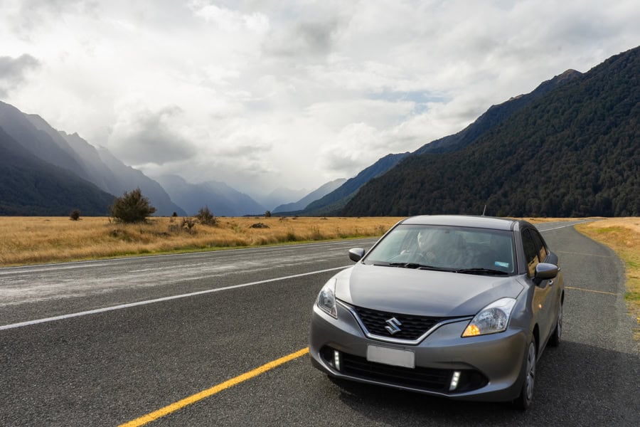
When we hiked the Routeburn, we did it as part of a New Zealand South Island road trip and we had a rental car for the duration.
Our go-to for car hire when we road trip is DiscoverCars as they bring together vehicles, prices and rental conditions from a wide mix of providers, both big and small. Booking in advance means better rates and more choice.
If you plan to drive a hire car to the Routeburn Shelter, check your rental car policy and insurance covers you for driving on unsealed roads.
What to pack
When you’re hiking for 3 days, pack weight matters. Especially on those tough climbs.
As we were camping on the Routeburn, we carried everything we needed: tent, ground sheet, pegs, roll mats, sleeping bags, food for 3 days, water bottles, cooking gas and burner, bowls, utensils and clothes. We opted for dehydrated dinners to save on grams (they deserve a post all their own).
Routeburn weather is also a serious factor when packing. It can change at a moment’s notice, leaving you wet, cold and unhappy if you aren’t prepared, particularly if you’re camping.
Quick dry layers, warm clothes, rain gear, pack covers and/or pack liners to protect the stuff inside your bag, are a must, no matter when you go. Pack for all conditions and carry extra food just in case you’re delayed for whatever reason.
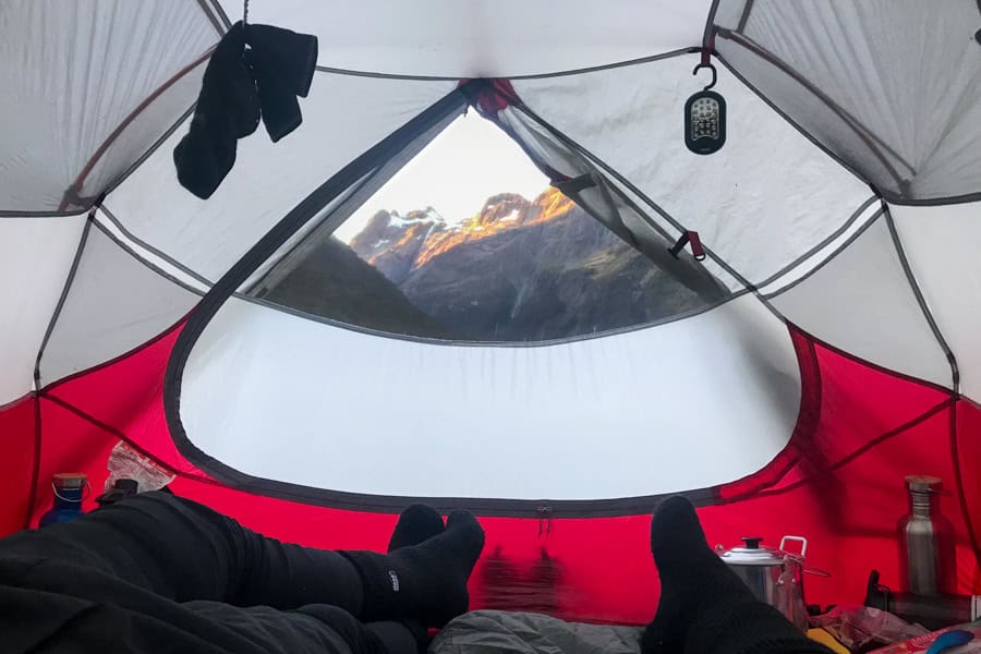
We tramped in late April, in the final days of the Great Walks season. While we lucked out with blue skies and warm days for most of the hike, we ended up wearing every single layer we’d packed on the freezing cold nights in our tent. One morning, we awoke to a tent decorated in delicate icicles.
Check out the suggested pack list on the DOC’s Routeburn Track webpage for what to wear and what to take with you on the trek.
Where to stay before and after the trek
The nearest big towns to the Routeburn hike trailheads are Queenstown (70km from the Routeburn Shelter) and Te Anau (85km from The Divide).
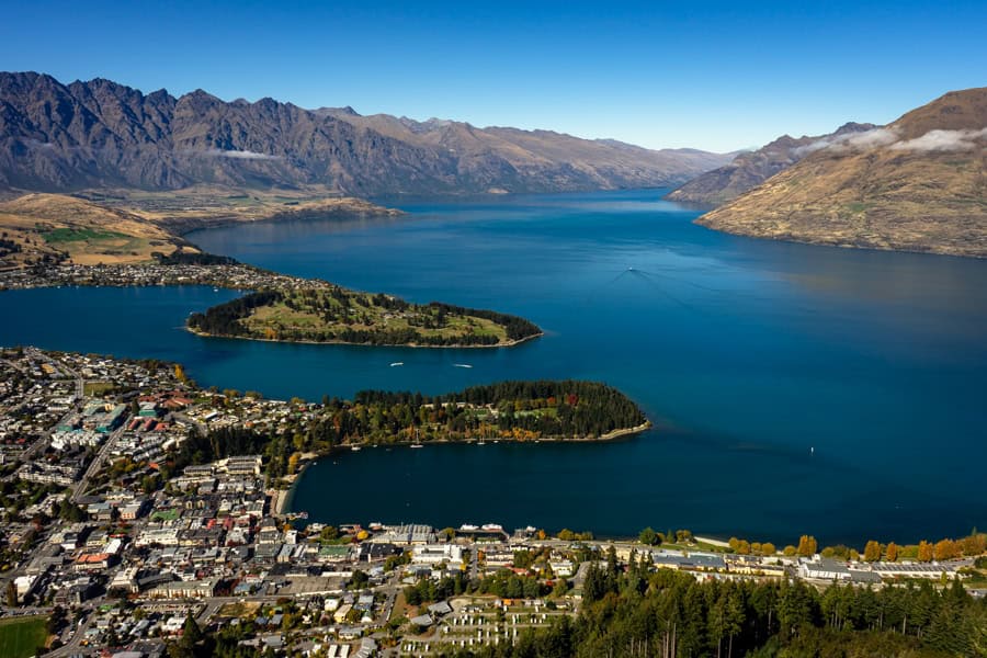
Queenstown accommodation
Queenstown is a stunningly beautiful, hugely popular, year-round travel destination, and accommodation prices reflect it. Even a basic double with a shared bathroom in a hostel here can set you back a small fortune.
If you’re happy to stay a little further from the buzz, it’s possible to find more affordable stays in smaller settlements nearby, like Arrowtown, which offers a quieter pace and better value.
The closest village to the Routeburn Shelter trailhead is Glenorchy – accommodation is more limited than in Queenstown but you can find options in the town and surrounding area, from hostel to boutique luxury.
Here are some Queenstown accommodation suggestions at different price points to get you started (bear in mind our scales here are relative as Queenstown is $$$):
- Budget: Haka House Queenstown Lakefront – This modern, well-run hostel is right on Lake Wakatipu, and gets top marks for its central location, clean and comfortable spaces, and the friendly, social atmosphere; there are reasonably priced dorm beds but you can also fork out a bit more for a private room with share bathroom or ensuite.
- Mid-range (in town): Scenic Suites Queenstown – A spacious, well-located hotel and apartment-style stay just a short walk from the centre; guests like its spacious, clean, well-equipped suites (some with lake and mountain views), which make it comfortable for both short and longer stays.
- Mid-range (just outside town): Moonlight Escape Lodge – Tucked away in a forest setting just outside Queenstown, this stay is highly-rated for its genuinely warm hosts, standout homemade breakfasts, and cosy lodge atmosphere; there’s also an outdoor cedar hot tub, perfect for a pre- or post-Routeburn hike soak.
- Spend a bit more: The Rees Hotel and Luxury Apartments – A stylish lakeside retreat with large, contemporary rooms and apartments and stunning lake views; guests give top marks to the service and helpful staff, and there’s a handy complimentary shuttle to the centre of town.
We stayed at Mi-pad Queenstown, a modern little boutique hotel within walking distance of the town centre. Our room was clean and cosy and we loved the rooftop terrace with its views and outdoor gas fire. I personally found the partially-frosted glass walls in the bathroom a little privacy-challenging, but that’s just me.
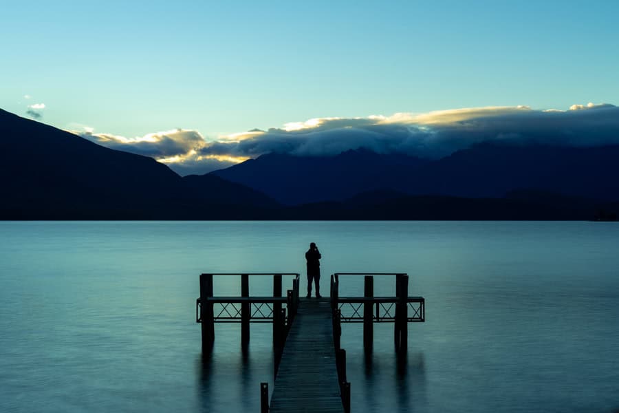
Te Anau accommodation
Across the Southern Alps, at the gateway to Fiordland National Park, sits the town of Te Anau. Here you’ll find a slower, more laid-back pace than Queenstown, and a more serene lakeside scene (though the drama of Milford Sound is just 2 hours up the road).
The Te Anau accommodation offer is a practical mix of motels, B&Bs and self-contained apartments, largely geared towards the road tripping, hiking and backpacking markets.
Prices are generally more palatable than Queenstown. Add a relaxed lakeside setting and a quieter evening vibe, and Te Anau is a comfortable, good-value base before or after a Routeburn hike, especially if you want to visit Milford Sound as well.
Here’s a collection of suggested Te Anau stays:
- Budget: Te Anau Lakefront Backpackers – Go for the glamping option or a private room at this relaxed hostel; it’s right on the lake and an easy walk into town; the staff are noted for being friendly and helpful; and there’s a well-equipped communal kitchen plus decent social areas.
- Mid-range: Aden Motel – This lovely motel has a top rating for its spotlessly clean and spacious rooms, the peaceful setting near the lake and town centre, and the welcoming hosts.
- Mid-range: Marakura Deluxe Motel – A laid-back motel right on the lakefront; guests rate the large, clean, well-equipped units and their lovely lake views, the location not far from town, and the comfy lounges and kitchenettes that make it easy to stay longer.
We stayed at the Parklands Motel and Apartments and highly recommend. There was plenty of space in our clean, comfy room, and we were within walking distance of restaurants and the lakefront. Staff were great and there was free, on-site parking. There’s also a well-equipped shared kitchen and barbecue facilities.
Hiking the Routeburn Track – What to Expect
The Routeburn Track is a 33km point-to-point trail through the high alpine terrain of New Zealand’s Southern Alps. The track climbs around 800 metres in altitude as it passes up and over the Harris Saddle.
As you hike the Routeburn, you’ll trek through beautiful beech forest and sweeping glacial valleys, passing open alpine meadows and glittering mountain tarns (lakes).
As you cross the highest point, you’ll tramp along ridge lines surrounded by spectacular mountain panos, before winding down into mossy, vivid green rainforest (or vice versa, depending which way you hike).
The sheer diversity of landscapes and changing scenery is one of the things we absolutely love about this trek, along with the monumental mountain-and-valley views throughout.
Was it tough? In parts, yes. Would we do it again? In a heartbeat.
Trail conditions
Tramping during the Great Walks season, we found the track to be well-formed and easy to follow.
The track is a mix of gravel and packed earth paths, boardwalks, and narrow, rocky alpine stretches. Some sections are rough and uneven underfoot, and there are sheer drop-offs in places. There are bridges over the river crossings so you shouldn’t need to get your feet wet.
The wayfinding is clear and visible, with directional signs at key points, as well as bright orange triangles and orange poles marking the track throughout.
Be aware though that at any time of the year, weather and environmental hazards can very quickly change the situation in this remote area. And out-of-season, when snow blankets the landscape, hiking here is an entirely different experience that requires advanced backcountry trekking skills. Keep tabs on forecasts and park alerts before you go.
Visitor centres and facilities
There are no shops or cafés on or anywhere near the Routeburn Track, so bring everything you need, plus some extra food supplies.
You’ll find toilets at both of the trailheads, and at all the huts and campsites. There are also a couple of drop loos along the route. To be on the safe side, when you see them, use them.
The nearest DOC visitor centres are in Queenstown and Te Anau; it’s worth dropping by one of them before your trek for a chat to the staff about Routeburn Track weather forecasts, trail conditions and alerts, bookings and other information.
There’s a DOC ranger-in-residence at each of the Routeburn Track huts throughout the Great Walks season.
Phone reception, internet and power
There’s no mobile/cell reception within the park, and no internet access. The only power at the huts is solar-powered lighting; there are no charging points. We carried power banks with us and kept our phones in airplane mode to preserve the batteries.
Perfect excuse to fully unplug and immerse in this spectacular place.
Water supply
The crystal clear water in the river, streams and waterfalls along the Routeburn looks very inviting, but can you drink it?
The DOC takes a conservative view and recommends treating or boiling water first. The same goes for the water supplies at the huts and campsites.
We did fill up at some rushing streams, with no apparent side effects. We mainly filled our bottles at the shelter and campsite taps. Luckily, no problems there either, but we would carry treatment tablets or a filtration bottle next time so we don’t have to run the gauntlet.
Didymo, a freshwater algae, is an issue in NZ right now, including in some streams on the Routeburn. Efforts are underway to prevent its spread, and the DOC has signage at impacted streams advising against taking or drinking water from them.
Safety tips
Check weather and park alerts before you trek: NZ weather can turn on a dime and in a remote alpine region like this, it can make trekking challenging and potentially unsafe. Keep an eye on Routeburn Track weather forecasts before you head out, and DOC alerts for the track.
Stay on the trail: Sticking to the track keeps you safe and protects the environment. The Routeburn Track route has directional signs along the way, as well as orange triangle track markers in the forest areas and orange poles in open and alpine areas.
Pack for the trek: Plan for all seasons and all weather when packing for the Routeburn. Wear sturdy shoes, have a hiking first aid kit, and carry extra food just in case. Drink plenty of water along the way.
Getting help: The DOC encourages trekkers to carry a personal locator beacon. It can make all the difference in an emergency. They’re available to hire for a small cost from the DOC Queenstown visitor centre and camping/outdoor stores in Queenstown and Te Anau.
There are also DOC rangers at each of the huts during the Great Walks season and they have access to emergency radios.
Let someone know you’re trekking: Tell family or friends when you’re setting out and when you expect to be back. Don’t forget to check in with them on your return.
Our Experience on the Routeburn Hike
While the Routeburn Track can be hiked in either direction, we opted to trek east to west: from Routeburn Shelter to The Divide, in keeping with our New Zealand South Island road trip plans.
We camped but there are also huts at each of the overnight locations we stayed in, so you can easily follow our itinerary below and stay in huts instead. This is how we did it:
Day 1: Routeburn Shelter to Routeburn Flats
Total distance: appx. 7.5km
Total hiking time: around 3 hours
Overnight stop: Routeburn Flats
Our Routeburn adventure started in beautiful Queenstown. We loaded up our hire car and set out at 10.30am on the gorgeous drive along vivid blue Lake Wakatipu to the tiny town of Glenorchy, 45 minutes from Queenstown.
At Glenorchy, we stopped to collect a key lock box for our car relocation (see the section on getting to and from the trailheads).
Once we had our key box, we moved on to Routeburn Shelter, the trailhead for the Routeburn Track in Mount Aspiring National Park. From Glenorchy, Routeburn Shelter is around 30 minutes down a partially unsealed road.
There are clean, flushing toilets at Routeburn Shelter. These are the last flush loos campers have access to on this leg, so take advantage (the huts have flush toilets in season).
The first day of the Routeburn is relatively short and easy. We were on the trail by 12.15pm, on a gentle upward sloping path through pretty beech forest. Within 15 minutes, we’d reached a swing bridge, the first of several today. Mountains soared in the distance, teasing the views to come.
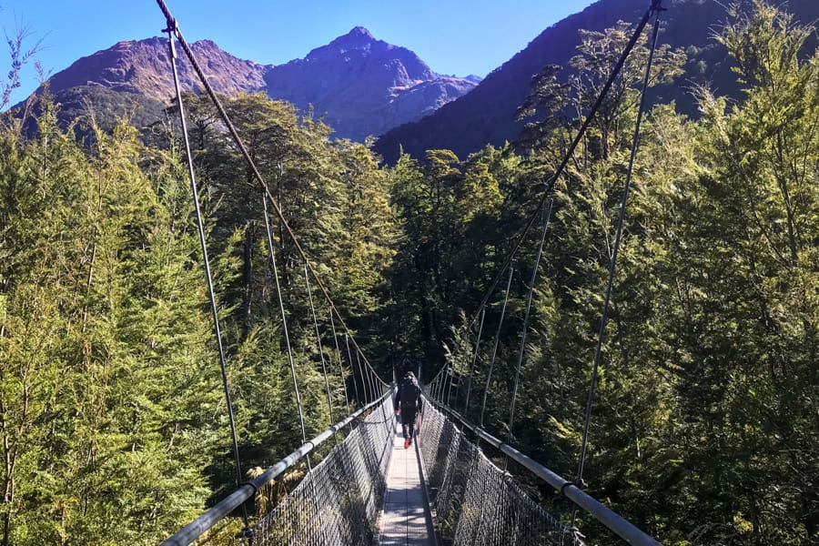
We continued our upward meander, with sunlight dappling the trail through the trees. Soon there were speccy glimpses of the valley far below.
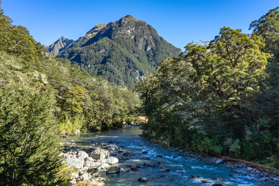
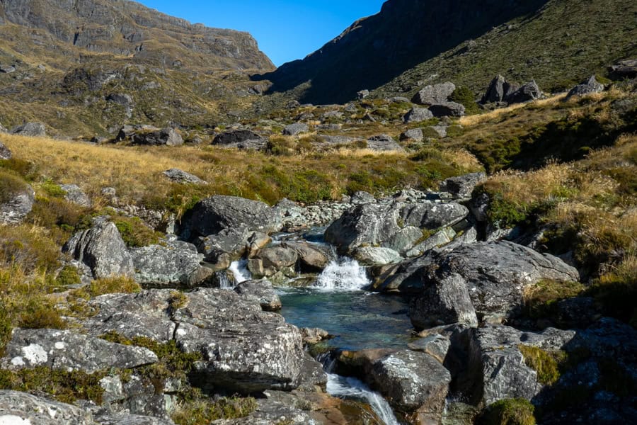
Around 1pm, we arrived at beautiful Bridal Veil Falls and another bridge crossing. Climbing above the gorge, we were soon moving parallel to the impossibly blue Route Burn River, which has its sources in the Humboldt mountains.
We stopped for lunch around 1.30pm by this gorgeous rush of glacial water, and were soon joined by one of the hike’s very friendly locals, a South Island robin. He hopped about our feet on the lookout for stray crumbs, completely unfazed.
We also came across a drop toilet conveniently stationed just past our lunch stop.
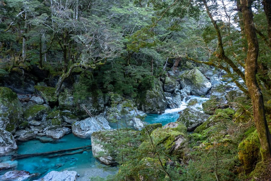
After a couple more swing bridges, and a photo stop among the boulders and rapids of the Route Burn, we emerged into a wide, grassy valley with mountains rising sheer from the plains. The Routeburn Flats hut and campsite are in this dramatic valley.
Soon enough, we reached the hut through the forest edging the valley. The campground is 10 minutes past the hut. We arrived at Routeburn Flats campsite around 3.15pm.
Overnight at Routeburn Flats
Routeburn Flats is a stunning spot to wind up this day on the trail. We highly recommend getting here with plenty of daylight so you can appreciate the gorgeous surrounds.
Trek tip: Routeburn Flats is the only campsite on this side of Harris Saddle. If you’re planning to stay in huts, however, you have a choice of two huts on this side: Routeburn Flats or Routeburn Falls, a further 2.3km up the track.
If you opt to stay at the Routeburn Falls hut, we recommend starting today a little earlier as the hike from the Flats to the Falls is all uphill and takes another 1 to 1.5 hours.
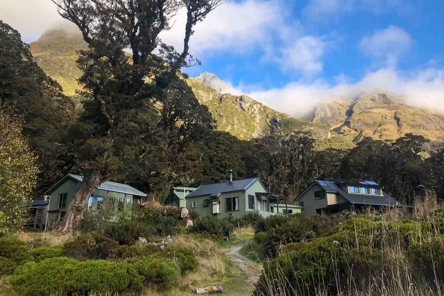
Routeburn Flats huts
The hut at Routeburn Flats has 20 bunks with mattresses and – in season – flushing toilets, running water, heating with fuel, and cooking facilities with gas supply. You still need to BYO sleeping bag, cooking and eating utensils and food.
These facilities are scaled right back out-of-season – there’s no gas, the running water is turned off, and there are pit toilets instead. There’s no ranger on site and bookings aren’t required, so it’s first in, best dressed.
The same seasonal arrangements apply at all of the huts on the trail.
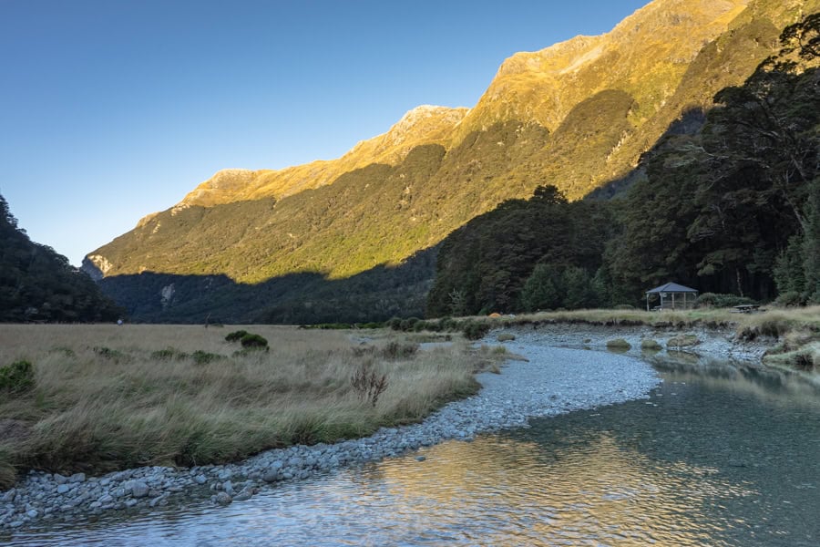
Routeburn Flats campsite
The camping area here is in a spectacular open grassy space, backed by trees and mountains and looking out on an amphitheatre of snow-smudged rises. A shallow branch of the Route Burn, paved in smooth pebbles, trickles a winding path in front.
A clean, modern drop toilet hides out of sight among the trees behind the camp. It had toilet paper and hand sanitiser when we were there and, as drop toilets go, it wasn’t bad. There are also a couple of basic shelters, each with benches, a table and a sink with cold, running water.
The fifteen campsites here are marked out as flattened spaces in the tall grass. Some have low wooden benches at their head. There’s plenty of space between sites.
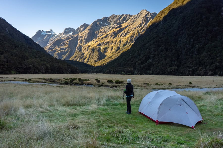
We chose a spot and were starting to unpack when we came face to face – quite literally – with what must be the Routeburn’s only undesirable feature: sandflies. Within moments we were swarmed, and quickly grabbed our stuff to find a site further back from the river.
That seemed to be the right call as our next spot offered a bit more respite. Still, the tiny biters meant we wasted no time putting up our tent, before making a hot drink and climbing in to enjoy the last of the day within the safety of the tent mesh.
Trek tip: Sandflies are blood-hungry little black flies and if you stand still, they’ll find you in a flash and bring all their mates. There’s no avoiding them either, they’re part of the New Zealand experience.
Keep moving, or better still, buy a locally-made repellent as apparently it’s more effective than the usual concoctions. We stuffed up and forgot repellent altogether = major fail.
A friendly ranger dropped by our tent a little later to say hi and check we had a campsite booking (download your booking confirmation to your phone before you trek, or bring a printed copy).
Despite a beautifully warm day, the temps dropped quickly once the sun went down, and we soon realised that our sleeping bags, which were rated to 5 degrees, didn’t cut it. So we were very grateful for the thermals, fleeces, neck warmers and beanies we’d packed, all of which went on. After a warm dinner and some stargazing, we were tucked up by 9pm.
Day 2: Routeburn Flats To Lake Mackenzie
Total distance: appx. 12.6km
Total hiking time: around 7.5 hours
Overnight stop: Lake Mackenzie
1st Leg – Routeburn Flats to Routeburn Falls
(appx. 2.3km / 1 hour 15 minutes)
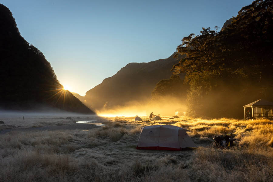
We were up with the dawn on Day 2 of our Routeburn hike. We emerged from our tent to a rising mist and a heavy frost that had powdered the valley overnight and coated our tent in a layer of ice.
After a warming brekky of coffee and oats, we de-iced our tent (with a cloth we’d packed for this very purpose), packed up our site and hit the trail at 9am.
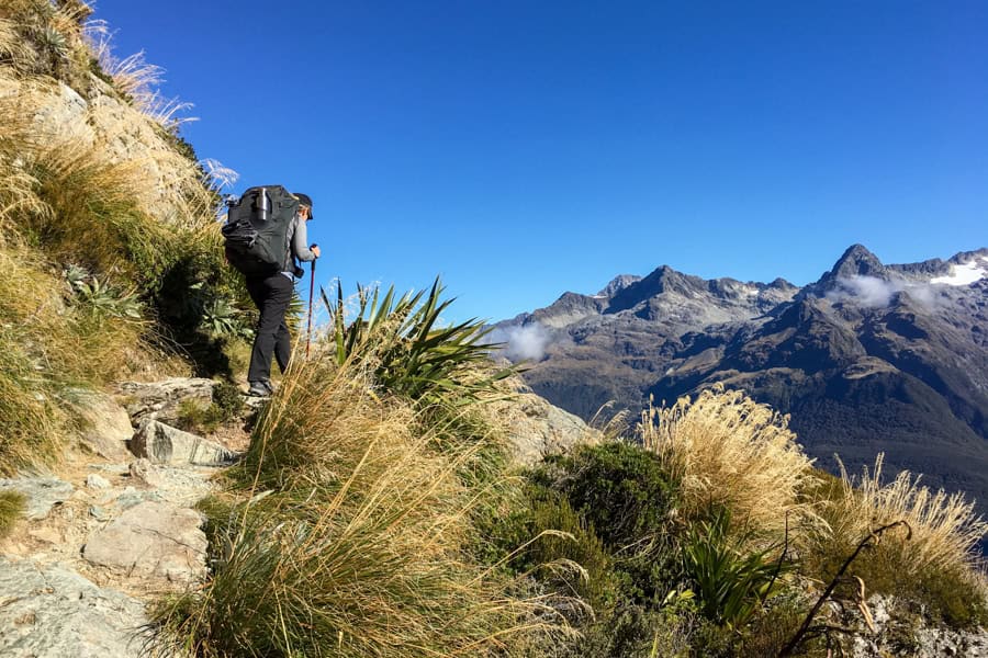
It’s a steady climb out of Routeburn Flats to Routeburn Falls. While we set out wearing a dozen layers to combat the early morning chill, we’d peeled off almost every layer within 15 minutes.
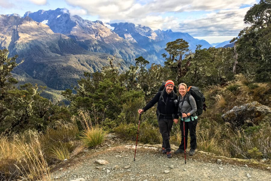
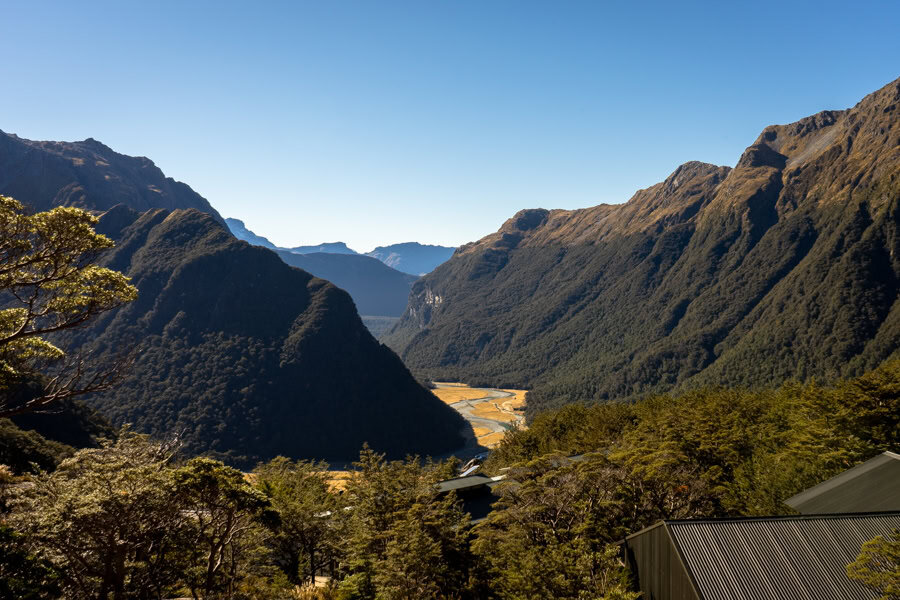
Crossing a narrow bridge around 45 minutes after leaving the Flats, we reached one of Routeburn’s most iconic viewpoints: a spectacular panorama over the valley we camped in last night, surrounded by the Humboldt mountains.
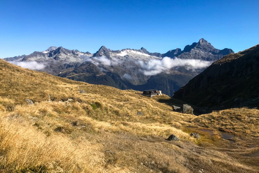
We hauled into Routeburn Falls around 10.15am, and stopped for a snack and to admire the views from this beautiful, mountainside stay.
There’s a 48 bunk hut at Routeburn Falls with the same facilities as the Routeburn Flats hut. It’s a great alternative to the Flats, or perhaps an option for another night in this beautiful area.
2nd Leg – Routeburn Falls to Harris Saddle
(appx. 3.4km / 2 hours 15 minutes)
We were back on the trail at 10.45am. About a minute from the huts, we passed the actual Routeburn falls, a series of pretty cascades.
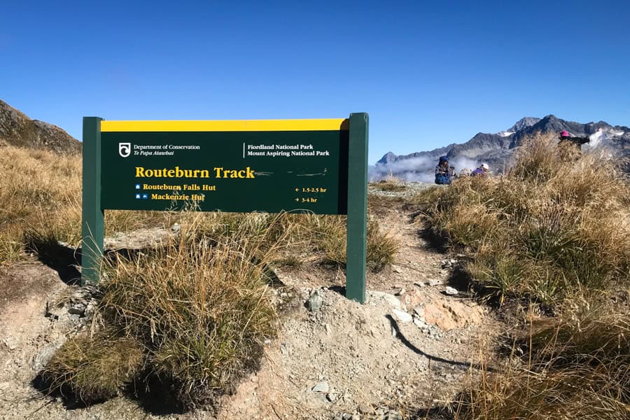
While the last climb felt like a bit of a work out, it’s about to get serious. From here, the trail rises to Harris Saddle, the highest point on the Routeburn Track route at 1,255m.
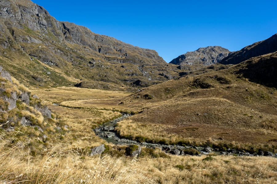
The initial climb is steep but we were soon passing through a wide, beautiful valley before climbing again. It’s tough and exposed through here. And spectacular.
It was also scorching hot when we tramped. Just remember to top up your water bottles at Routeburn Falls and stay hydrated on the way up.
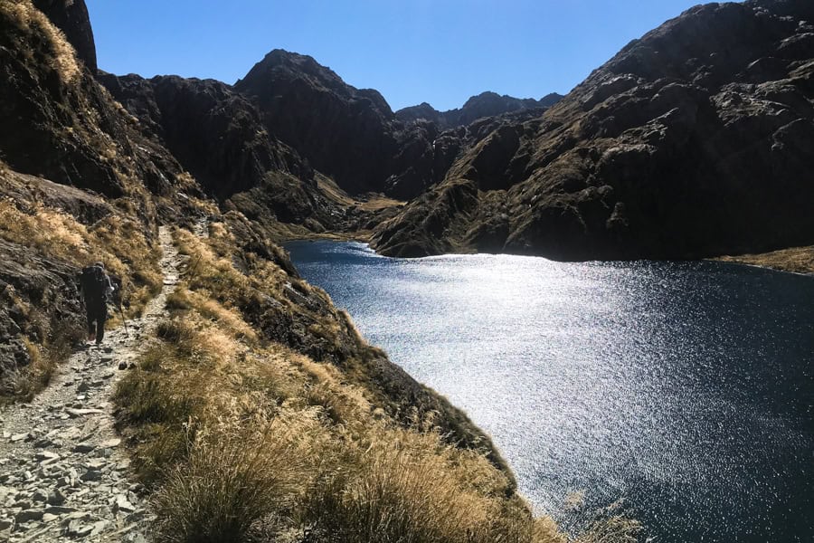
After passing through an impressive rock arch, sparkling Lake Harris comes into view. We pitched up on a rock here to catch our breath, rehydrate and refuel with epic views over the lake and back down the valley.
From our perch, we next travelled along a narrow, rocky path above Lake Harris before finally reaching the day shelter at Harris Saddle around 1pm.
There are a couple of drop toilets out the back, but no water for refills, so again, be sure to top up before leaving Routeburn Falls.
We paused at the Harris shelter for around 30 minutes for lunch and a loo break.
Trek tip: If you’re making good time on Day 2 and still have plenty of energy, consider a side trip from Harris Saddle up to the peak of Conical Hill at 1,515m.
The steep trail leads from the Harris shelter and takes 1-2 hours return. Weather can dictate whether this is a go or not, but if the skies are clear, the views out to the Tasman Sea are apparently outstanding.
With another 3-4 hours of hiking ahead of us, and with shorter daylight hours in late April, we opted to keep going and leave Conical Hill for a future trek.
3rd Leg: Harris Saddle to Lake Mackenzie
(appx. 6.9km, around 3.5 hours)
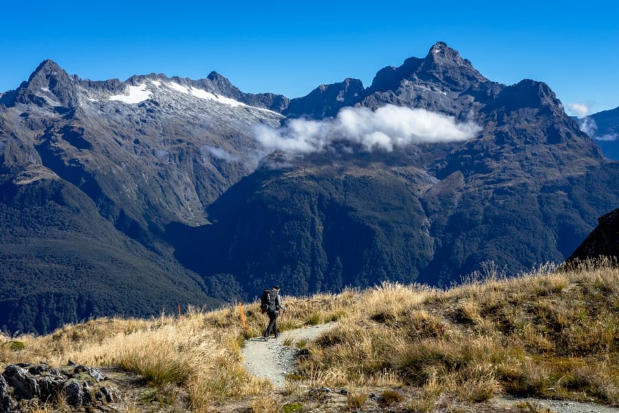
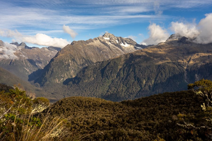
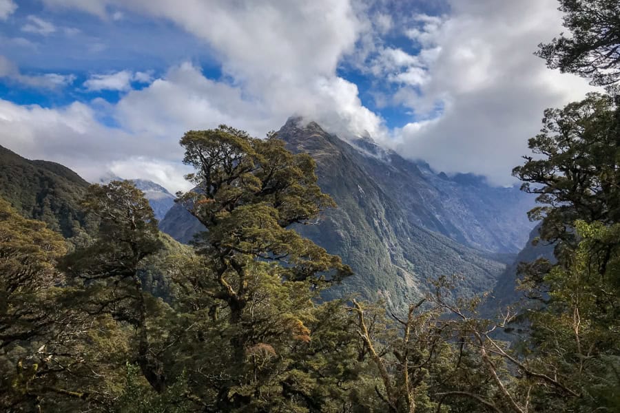
The final leg on Day 2, from Harris Saddle to Lake Mackenzie, involves an eye-popping mountain ridge amble, followed by a doozy of a downhill trek.
After lunching at the Harris shelter, we were back on the track at 1.30pm and passed around the mountain onto the spectacular Hollyford Face. The panos here are vast, with the Darran Mountains soaring above the valley far below.
As you hike across Harris Saddle from east to west, you also pass from Mount Aspiring National Park into Fiordland National Park.
We noticed an intriguing savoury smell along much of the trail through here, and it was particularly strong along the Hollyford Face. We joked it was just us after all the exertion, but it was more likely the shrubby alpine herbs growing along the track.
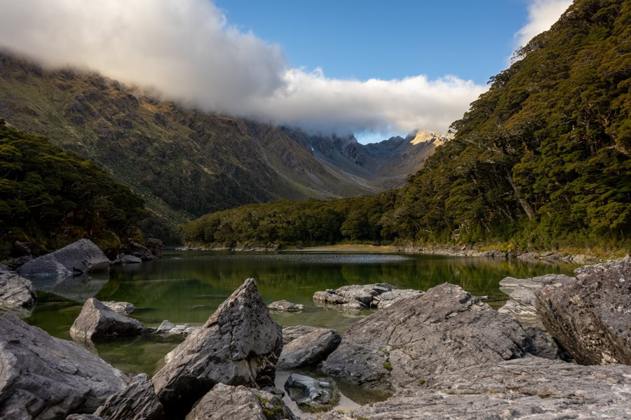
Climbing over a rocky pass, we gained our first glimpse of Lake Mackenzie around 3.30pm. The narrow lake stretches along the valley floor at the foot of a striking, glacier-cut basin. Huge boulders litter the front end of the lake.
The track to the Lake Mackenzie hut and campsite zig zags down the mountainside. Big steps, loose scree and rubble in places made this stretch a tricky, slow trek for us.
Fortunately, we were distracted from our protesting knees at one point by the calls of a kea, one of the Fiordland’s most endearing characters. Before long, a couple of the cheeky endangered parrots had landed nearby to check us out.
Kea are the only alpine parrots in the world, and they’re also among the smartest. They’re known to pinch things from unsuspecting tourists from time to time. We were thrilled to finally encounter some up close…and walk away with all our gear.
The final stretch of the trail on this leg passes through a beautiful mossy forest, all vivid greens and very atmospheric.
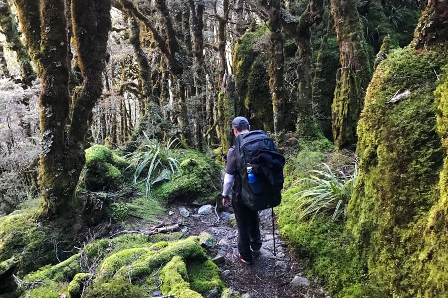
We were feeling the effects of a long day’s hike and on a bit of a mission by this stage, so we were very happy to finally emerge from the forest at the Lake Mackenzie hut around 4.30pm. The campsite is around 10 minutes further on.
Overnight at Lake Mackenzie
Lake Mackenzie hut
The Lake Mackenzie hut sits in the shadow of a beautiful mountain backdrop and has 50 bunks.
The facilities are the same as the other huts in season: shared sleeping and eating spaces, flush toilets, wash basins with cold-running water, heating and cooking facilities (BYO food, bowls and utensils).
As with the other huts, these facilities are scaled back during the off-season.
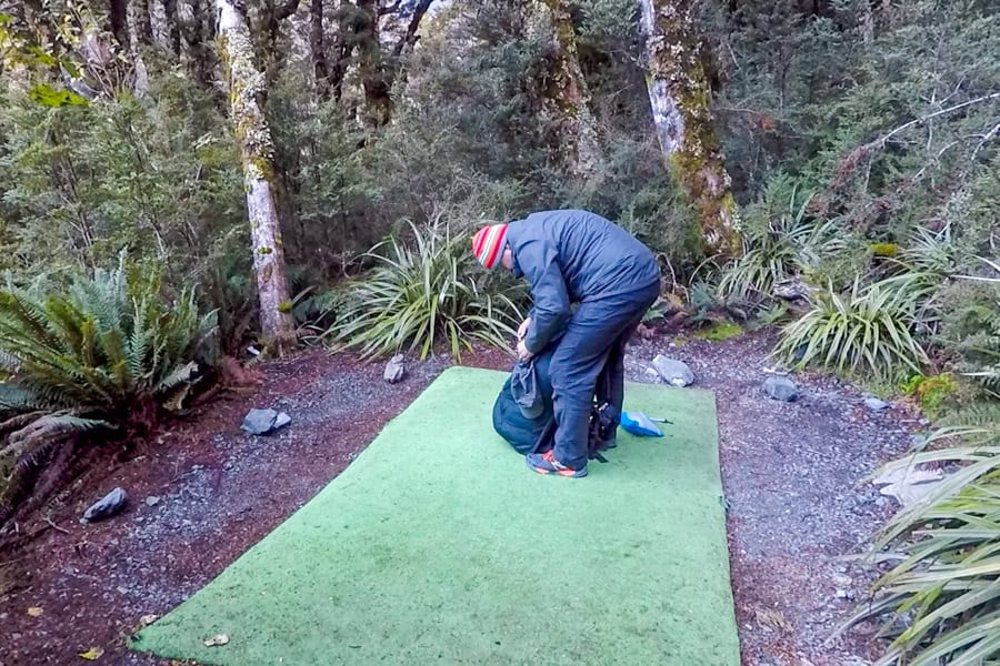
Lake Mackenzie campsite
The campground here is tucked into the forest near the lake: a tight set-up of nine campsites leading off a central pathway.
Each campsite is separated by low ferns and brush. The ground is rock hard, so the DOC has built rectangular dirt mounds in each space, covered with an astro-turf-like material, so campers can peg their tents. There were also a bunch of rocks around to lash, weigh and pound with.
There’s a good-sized shelter with picnic tables and a long, double-sided bench with sinks and cold water taps.
There are also two drop toilets; one was quite new when we trekked, the other was a bit tired and unpleasant. Hopefully it’s been replaced but if not, go for the one closer to the campground entrance.
We were so stoked to arrive, get our packs off and stop moving on this day that we completely forgot to take any pics of the Lake Mackenzie campsite. Here’s a frame from the one short video we shot:
While the forest surrounds are stunning, we felt a bit more claustrophobic in this campsite after the wide open space of Routeburn Flats. We were near enough to our tent neighbours to hear their whispers. Bring earplugs.
Like the previous night, a friendly DOC ranger popped by the campground in the early evening to check everyone had Routeburn Track reservations.
After setting up our tent and working our way through another couple of rehydrated meals, we layered up and crawled into our sleeping bags to reflect on another epic day.
Day 3: Lake Mackenzie to The Divide
Total distance: appx. 12km
Total time: around 6.5 hours
Finish: The Divide carpark
1st Leg – Lake Mackenzie to Lake Howden
(appx. 8.6km, around 4 hours)
If you’re hiking the Routeburn Track from east to west as we did, it’s mostly downhill on Day 3 as you make your way across the range and descend to The Divide.
First though, there’s a climb out of the Lake Mackenzie valley. Breakfasted and packed, we were on the trail at 8.15am. It felt early to us but we were still among the last to leave the campground.
We strolled among the boulders at Lake Mackenzie’s edge, then walked past the huts and a stunning private guided walks lodge. We passed through a flat grassy area with mountains soaring above us, before starting a 45-minute climb.
It definitely had our hearts racing, but continuing on, we were eventually rewarded with absolutely spectacular mountain panoramas.
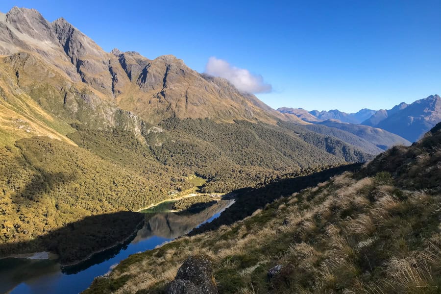
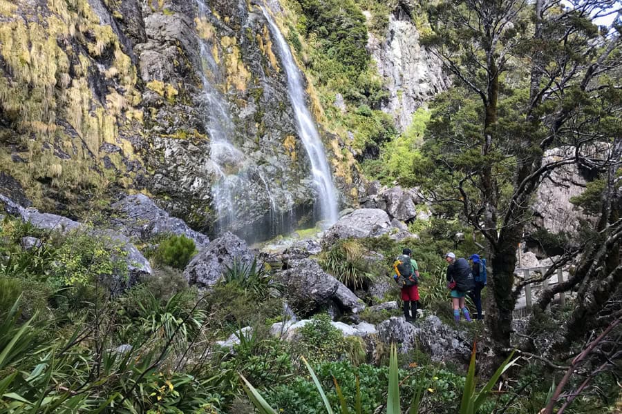
After stopping for a snack and some time soaking up the scenery, we started a gentle decline that took us through a lovely area called The Orchard and on to Earland Falls, where we arrived a little before 11am.
Earland Falls is a picturesque spot with boulder-scattered crystal clear pools at the foot of a 174-metre curtain of water.
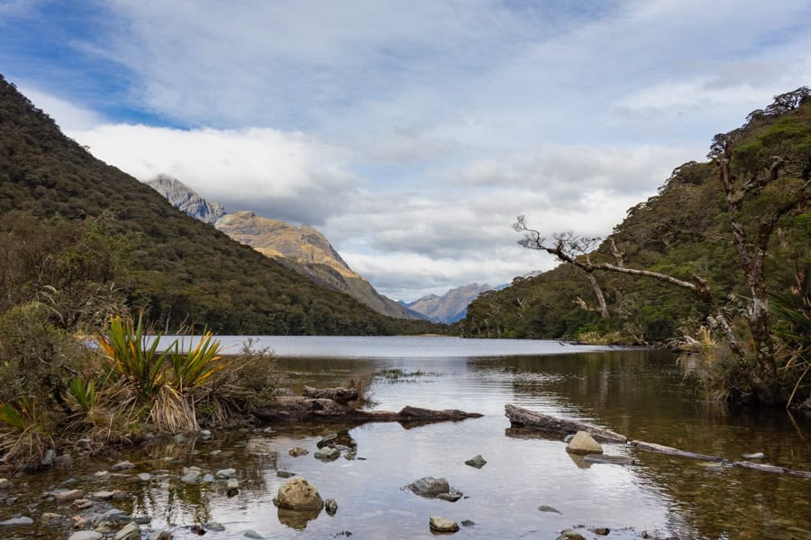
From Earland Falls, we walked another hour or so through pretty forest before we popped out to cross a low wooden walkway to the Lake Howden shelter. We arrived here just before midday.
There used to be a hut at Lake Howden but it was destroyed by a landslip in 2020. There’s now a small day shelter where you can take off your bags for a bit and soak up views like this:
2nd Leg – Lake Howden to The Divide
(appx. 3.4km, around 1.5 hours)
From Lake Howden, it’s just one more hour to The Divide carpark and the east-to-west end point of the Routeburn Track (or the start if you’re trekking the other way).
We absolutely lucked out with the Routeburn weather on our first two days. But the forecasts at the huts en route were predicting rain around midday on our last day and clouds had been steadily building all morning.
On cue, just as we sat down to take in the scene at Lake Howden, a very light rain started to fall. We weren’t keen on waiting around for it to set in, so we cut short our break and got back on the track at 12.15pm.
From Lake Howden, it’s a steep, 15 minute upward slog. When we reached the top of the rise, we found the turn off to the Key Summit Track, a popular hike that draws lots of day-trippers from Te Anau and Milford Sound for its epic views.
By this stage, rain clouds were hugging the peaks behind us and the summit views were closing in, so we decided to keep moving.
Side trip: For Routeburn trekkers travelling east-to-west and finishing at The Divide, the Key Summit turn-off is around 15 minutes from the Lake Howden shelter.
If you’re coming from The Divide, it’s an hour’s hike up from the carpark along the Routeburn trail to the start of the Key Summit Track.
The trek to the Key Summit viewpoint is around 20 minutes one-way. The mountain views from the top are said to be phenomenal in good weather, and there’s an alpine tarn up there too.
The last stretch is downhill all the way, through pretty forest serving up glimpses of cloud-shrouded peaks to the right. Kea calls accompanied us along the way.
Just before we reached the end of the trail, we passed under an impressive archway of branches; it felt like an appropriate finish for this incredible trek.
We stepped out into The Divide carpark at 1:15pm, exhilarated, invigorated and firmly adding the Routeburn Track to our list of favourite hikes around the world.
Our car was right there waiting for us in the carpark too. Sweet as.
Guided Routeburn Hikes
It’s very straightforward to plan, book, and hike the Routeburn independently during the New Zealand Great Walks season.
However, having a guide can take a trek to the next level, whether you’re after the insights of an expert in the local landscape, enjoy meeting new people and hiking with a group of fellow travellers, or want a more comfortable lodge-based experience.
For the Routeburn, there are guided options such as:
- this Routeburn Track Guided Full-Day Walk that includes transport from Queenstown, a scenic drive along the Queenstown-Glenorchy Road, a hike from Routeburn Shelter to the Routeburn Falls hut, and picnic lunch (there’s a half-day option available as well)
- this Routeburn Track and Key Summit Guided Day Walk from The Divide to the Key Summit and back; it includes a scenic drive along the Milford Road, picnic lunch, and pick-up/drop-off in the Te Anau area
- an exclusive, all-inclusive 3 day/2 night guided Routeburn trek with Ultimate Hikes New Zealand, staying in private lodges on the trail (these guys are the exclusive operators of multi-day treks on the Routeburn).
If a longer stretch of trekking in New Zealand appeals, this epic South Island Highlights 10 day Guided Hiking Tour with Flashpacker Connect will have you tramping through some of the South Island’s most epic landscapes and five iconic national parks between Nelson and Queenstown, including a Routeburn hike from The Divide to Key Summit followed by a boat cruise on Milford Sound.
Useful Travel Resources
Stays: We use Booking.com for its wide choice + Genius perks.
Airport Transfer: Welcome Pickups takes the hassle out of city arrivals and departures.
Car Rentals: We use DiscoverCars for a wide choice of hire cars with great rates and free cancellation.
eSIMs: Use Airalo to stay connected while you’re travelling around New Zealand (just remember you won’t have reception or internet while you’re on the Routeburn Track).
Tours & Experiences: For guided Routeburn day hikes, Milford Sound cruises, and other fantastic activities right around New Zealand, check out GetYourGuide.
Have you hiked the Routeburn Track, or another of New Zealand’s Great Walks? If you’ve got any comments or questions, drop us a message below.
If you’re travelling around New Zealand’s South Island, check out our post on other awesome places to see on the South Island. Or head to our New Zealand page for more travel inspiration for this wonderful country.